
 Italiano
 Deutsch
Gran Canaria- Pico de la Nieves -Telde
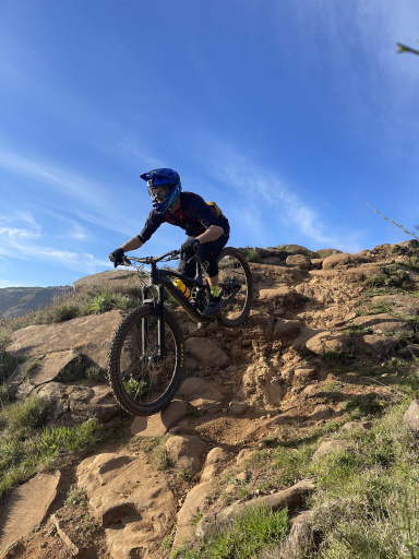
Gran Canaria, transfer by Bus to Pico della Nieve (1949 meters) highest point on the island, super scenic, mandatory for us given the distance from Mas Palomas. Small downhill section on road to the east then turn left, first part on dirt road then the first section a traverse on black volcanic ash, crazy freeride, the trail follows on dry path in the forest. Then after the Los Marteles caldera you cross the main road for the second part of trail, completely different environment: lots of green vegetation with red earth rock and incredible scenery. Be careful, possible some tourists on foot.
Once in Tenteniguada we pedal uphill on the main road until we catch the start of the Telde-Vasequillo trail (other route) which we enjoyed very much, same trail to Telde, and return by bus (very efficient on the island).


