Italiano
 Deutsch
Forti napoleonici da Affi

Itinerary not long, but with very challenging sections, both uphill and downhill. Very beautiful and scenic passages to the Napoleonic forts San Marco and Rivoli, as well as the Incanal cut.
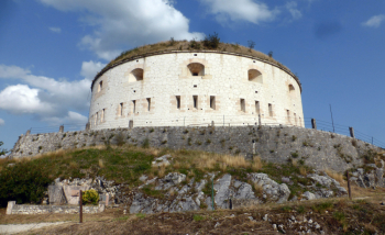
From Affi on secondary roads you reach the start of the climb to Fort San Marco and climb on old military road that is very bumpy but has a gentle slope thanks to the many hairpin bends, over rock and loose stones, to the fort. It is imposing, complete with moat and drawbridge (now a sad iron bridge).
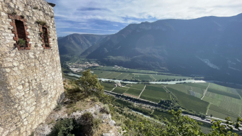
It is worth walking around the moat to see the drop to the Adige Valley, which we will later see from below.
From here trail and road downhill to the first village. The trail has sections brutally full of loose stones, so much so that it looks like a dry creek.
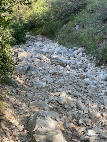
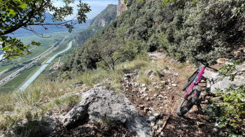
Once the descent is over, it climbs with steep sections to Pozza Gallet. Here the trail is in really bad shape, eroded and full of boulders. The last piece, a few dozen meters, will be to push. You first follow a rutted dirt road, then take what could be a beautiful trail by a hairpin bend to the left (pay attention to the trail so you don't miss it). It could be wonderful if someone would occasionally come by and cut back the vegetation on the first part, and remove some loose rocks on the second part. We are just above a rock wall that ends in the Adige Valley. There are 5-6 pitch climbing routes down there, just to give you an idea. Fortunately, the trail is well hidden in the woods except for this point:
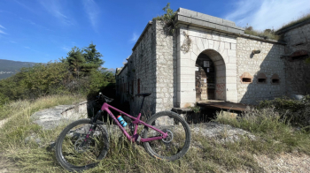
You end the descent at the Tessari farm, pass the overpass and head back south. You pass through the village of Canale, then the characteristic Incanal cut and turn left to the bike path that leads to the Rivoli fort, Werk Wohlgemuth, 1854, open to the public only on Sundays from 2 to 6 p.m., where you arrive with a short but intense climb. You descend, if you wish, by the little path that cuts through the hairpin bends and, by back roads, return to Affi.