
 Italiano
 Deutsch
Mount Marmagna and company
We are in the heart of the Hundred Lakes Park, among ridges and teeth-rattling rock'n'roll trails.
Tough ride with lots and lots and lots of portage and bad descents on sometimes sketchy nature trails; watch out for pedestrians, always give way. I recommend doing it off-season or midweek to avoid traffic.
Start from Bosco di Corniglio, the parking lot is just before the sports field.
We start on a short asphalt section that becomes forest to Monte Tavola.
By trail we aim for the Bocchetta del Tavola and with some pushing we reach the mouth of the Fosco. From here we descend on a nice trail until we come to a junction where we keep to the right.
We load the bike and uphill and pass the Braiola hut, reach the saddle and off on ridge 00 to the summit of Mt. Marmagna.
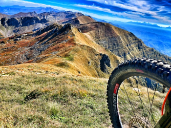
If you are lucky with the weather 360° spectacular view, from the sea to the Alps passing through a good slice of the Apennines from east to west.
From here we bike back up to descend to the Marmagna Saddle.
We put our beloved mtb back on our shoulders and set off again toward the Aquilotto. The ridge, always extra-panoramic, is exposed in some sections, pay close attention. In some places you are able to give two pedal strokes before putting the bike back on your shoulders. We continue to the summit of Monte Aquila, where we remount in the saddle for a few short sections until we reach Passo delle Guadine.
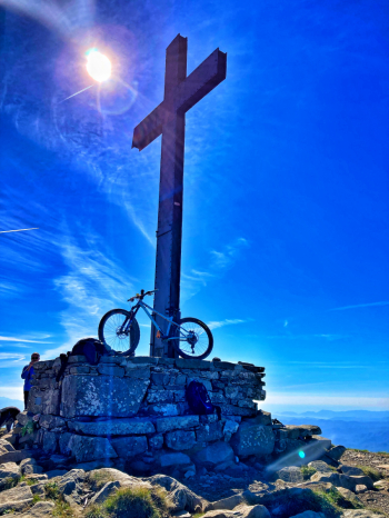
From here we descend through boulders, pebbles, and roots until we come to a forest road, the one leading to the Badignana huts; we ignore it and aim for Roccabiasca. After a short ascent and a small descent in the saddle, the bike returns to its place on the shoulders and off on the sometimes steep traverse uphill. We will only put the wheels back on the ground below the summit cross; space panorama!!!
The first part of the descent is on the uphill trail and then veers left and into the woods where the relatives of the boulders encountered earlier are waiting for us to party! At the end of the descent we come out on a forest trail that leads uphill to the Lagoni. From here we descend on the Parmetta trail, which is faster and less technical than the previous ones; from path it becomes forestry to find the asphalt again, only for a short stretch. At the first opportunity we take a left passing by a bar and return on the first steps of the day back to the car.